
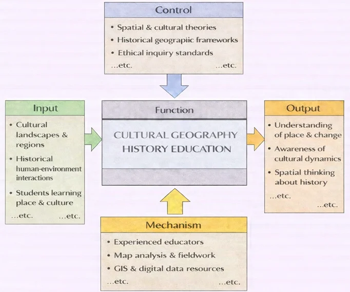
Cultural Geography History Education tells the story of the past through the lens of place. Instead of beginning with rulers and dates, it begins with landscapes, regions, routes, and boundaries—then asks how human choices and environments shaped one another over time. The inputs include cultural landscapes and regions that anchor learning in real locations, historical human–environment interactions that reveal patterns of settlement, trade, migration, and land use, and students who want to understand how culture becomes visible in space. The learning process is guided by controls such as spatial and cultural theories, historical geographic frameworks, and ethical inquiry standards, helping students interpret evidence carefully, avoid oversimplified stereotypes, and respect the communities represented in maps and records. The function is enabled by mechanisms like experienced educators, map analysis and fieldwork that train observation and inference, and GIS and digital data resources that allow students to compare layers of information across time. When these elements work together, the outputs are distinctive: a deeper understanding of place and change, sharper awareness of cultural dynamics, and stronger spatial thinking about history—seeing how the past leaves traces not only in texts, but also in the geography of everyday life.
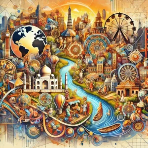
Cultural geography examines how human societies shape — and are shaped by — the physical and symbolic spaces they inhabit. It asks how place, landscape, and spatial organisation reflect cultural values, political power, and historical experience, and how those geographies change over time.
The history of ideas provides an important foundation. Philosophical and intellectual movements have repeatedly shaped how societies understand territory, belonging, and regional identity — from Enlightenment concepts of natural boundaries to nationalist ideas about homeland and sacred soil. Understanding these intellectual currents helps explain why certain landscapes carry such powerful cultural and political meaning.
Colonial history is central to cultural geography. The spatial claims made by colonial powers — the drawing of borders, the naming of territories, the displacement of populations — left lasting marks on cultural landscapes that postcolonial societies have had to negotiate ever since. Postcolonial cultural studies examines how those inherited geographies are contested, reinterpreted, and gradually reshaped through decolonisation and cultural reclamation.
Religion has shaped cultural geography in profound ways. Pilgrimage routes, sacred sites, monastery complexes, and religiously defined urban layouts all reflect how belief systems organise space and give it meaning. Religious and spiritual history illuminates these sacred geographies and the communities that have formed around them across centuries.
Economic forces have also been decisive in shaping cultural landscapes. Economic history documents how trade networks, agricultural systems, and industrial development transformed both the physical environment and the cultures that depended on it. Environmental economic history adds another layer, examining how cultural groups have adapted to, exploited, and sometimes irreversibly altered the ecological zones they inhabited.
Political structures leave their own geographic imprints. The history of political systems shows how states have used spatial organisation — borders, capitals, administrative regions, infrastructure — to consolidate power and project authority. Diplomatic history reveals how territorial disputes, treaty boundaries, and geopolitical arrangements have defined the cultural as well as the political map.
Finally, popular culture offers a more everyday lens on cultural geography — examining how media representations, urban subcultures, and shared uses of public space construct and contest the meanings attached to particular places. From neighbourhood identity to national iconography, the symbolic use of space is one of the most immediate ways culture makes itself visible.
Interactive Spatial Lab: Spatial Diffusion & Landscape Transformation Modeler
Select a cultural diffusion mechanism, landscape scenario, and spatial scale to simulate real-time geographic transformations and spatial interaction mechanics.
Simulated Spatial Matrix Result
Cultural Geography — At a Glance
What it studies
How people, beliefs, and practices shape spaces—and how places shape people.
Key lenses
Urban landscapes · migration · regions & identities · nature–culture relations · symbols.
Why it matters
Explains patterns of belonging, conflict, heritage, tourism, and policy on a changing planet.
Skills you gain
Spatial thinking · map literacy · fieldwork ethics · data + story integration.
Key Focus Areas in Cultural Geography
Urban Cultural Landscapes
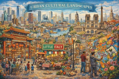
Urban cultural landscapes are the physical and symbolic spaces within cities that reflect cultural identities and practices.
Defining Urban Cultural Landscapes
- The built environment of cities—such as architecture, public spaces, and infrastructure—represents the cultural values and history of its inhabitants.
- Examples:
- New York City’s diverse neighborhoods, such as Chinatown and Little Italy, highlight the cultural imprint of immigrant communities.
- Paris’s Haussmannian boulevards and iconic landmarks like the Eiffel Tower symbolize French cultural and historical identity.
Urbanization and Culture
- Urbanization influences cultural practices by fostering interaction between diverse groups.
- Examples:
- Cities as centers of artistic innovation, such as the Harlem Renaissance in 1920s New York.
- Street art and graffiti as cultural expressions in urban environments, seen in cities like Berlin and São Paulo.
Challenges in Urban Cultural Geography
- Urban renewal and gentrification often disrupt cultural landscapes, displacing long-established communities.
- Balancing heritage preservation with modernization in rapidly urbanizing cities.
Migration Patterns
Migration is a significant focus in cultural geography, highlighting how the movement of people shapes cultural diffusion and transformation.
Cultural Diffusion Through Migration
- Migration spreads ideas, languages, religions, and traditions, influencing the cultural fabric of destination regions.
- Examples:
- The spread of Buddhism from India to East Asia through ancient trade routes like the Silk Road.
- The global influence of diasporic communities, such as Indian cuisine becoming popular worldwide.
Types of Migration
- Voluntary Migration: Economic migration for better opportunities, such as South Asians moving to the Gulf states.
- Forced Migration: The transatlantic slave trade or the displacement of Rohingya Muslims in Myanmar.
- Rural-to-Urban Migration: Urbanization in countries like China, where millions have moved from rural areas to cities, reshaping cultural landscapes.
Challenges and Impacts
- Cultural assimilation and the preservation of heritage in host societies.
- Tensions arising from cultural diversity, leading to policies like multiculturalism or assimilation.
Regional Traditions and Identities
Cultural geography examines how regions develop unique traditions and identities shaped by their physical and historical contexts.
Defining Regional Cultures
- Regional traditions are influenced by factors like climate, topography, and natural resources.
- Examples:
- Mediterranean cuisine reflects the region’s agricultural abundance of olives, wheat, and grapes.
- Indigenous practices in the Amazon, such as sustainable hunting and gathering, are adapted to the rainforest environment.
Cultural Regions
- Formal Cultural Regions: Defined by shared characteristics, such as language or religion (e.g., Latin America, where Spanish and Portuguese predominate).
- Functional Cultural Regions: Defined by interactions and node-based activities, such as metropolitan commuting corridors.
- Vernacular Cultural Regions: Defined by local perception and spatial identity, such as the “Deep South” in the United States.
Preservation of Regional Traditions
- Cultural geography helps document and protect endangered traditions, such as indigenous languages or artisanal crafts.
The Interaction Between Environment and Culture
Cultural geography explores how physical environments influence cultural behaviors and how human activities modify landscapes.
Environmental Determinism
- The theory that physical environments directly shape human culture (e.g., the Nile River’s fertile floodplains influencing ancient Egyptian agriculture and religion).
Cultural Ecology
- Focuses on the reciprocal relationship between humans and their environment (e.g., terrace farming in the Andes or nomadic herding in the Sahara).
Environmental Modification
- Humans actively shape their environments to suit cultural needs (e.g., the Netherlands reclaiming land via dikes and polders, or Amazonian agricultural clearing).
The Role of Cultural Symbols in Geography
Cultural geography investigates the symbolic meanings attached to places and landscapes.
Sacred Spaces
- Locations designated as sacred reflecting religious or spiritual significance (e.g., the Ganges River in Hinduism or Jerusalem across Abrahamic faiths).
Monuments and Landmarks
- Monuments serving as cultural symbols representing collective memory (e.g., the Taj Mahal’s Mughal architectural heritage or Mount Rushmore).
Cultural Festivals
- Festivals tied to specific locations highlighting human-environment interaction (e.g., Rio de Janeiro’s Carnival or Japan’s cherry blossom festivals).
Methods & Data for Cultural Geography
- Fieldwork & Ethnography: walking interviews, participant observation, sketch maps, photo-elicitation.
- Mapping & GIS: thematic maps of language, religion, festivals; story maps combining narrative + spatial data.
- Remote Sensing & Imagery: land-use change, urban expansion, cultural landscape detection.
- Text & Media Analysis: place branding, tourism brochures, film/TV locations, social media geotags.
- Archives & Oral History: historical maps, planning files, community memories, heritage inventories.
- Ethics & Inclusion: informed consent, representation of vulnerable groups, data sovereignty.
Tip: pair quantitative layers (e.g., census, mobility) with qualitative insights (stories, photos) for fuller explanations.
Key Terms & Concepts
- Cultural Landscape
- Visible imprint of human activity on the earth—buildings, field patterns, signage, sacred sites.
- Place
- Space made meaningful through lived experience, memory, and identity.
- Diffusion
- How practices, beliefs, or innovations spread across space (relocation, contagious, hierarchical, stimulus).
- Sense of Place
- Emotional ties and narratives that connect people to locations.
- Hybridization
- Mixing of cultural forms through contact—often visible in food, music, language, and urban design.
- Scale
- Analytical level (neighborhood ↔ global) at which patterns are examined; patterns can shift by scale.
Applications of Cultural Geography
Urban and Regional Planning
- Cultural geography informs planners about preserving cultural heritage while accommodating growth (e.g., designing inclusive spaces in Toronto or Singapore).
Tourism Development
- Enhances sustainable tourism by respecting local traditions and minimizing cultural commodification (e.g., ecotourism in indigenous communities).
Policy and Multicultural Integration
- Provides insights for managing cultural diversity and social cohesion (e.g., Canadian multiculturalism policy frameworks).
Climate Adaptation
- Analyzing how cultural behaviors respond to environmental changes aids in creating effective adaptation strategies (e.g., indigenous ecological knowledge systems).
Regional Snapshots & Case Studies
1. Historic District Gentrification (Urban Europe)
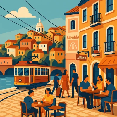
Place & Context: Alfama, Lisbon’s oldest hillside quarter, features narrow lanes and long-time residents. Tourism growth and short-term rentals led to rapid amenity upgrades and resident turnover.
Key Changes: Apartment conversions to tourist lets; shift from everyday retail to tourist services; displacement of multi-generational households.
2. Overtourism & Resident Pushback (Barcelona)
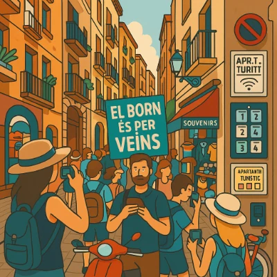
Place & Context: Barcelona’s Ciutat Vella concentrates world heritage and nightlife. Post-2000s platform rental surges triggered severe residential crowding and policy interventions like PEUAT licensing caps.
3. Creative-Led Regeneration (Bilbao)
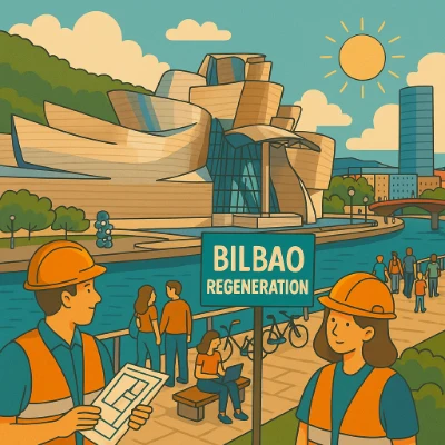
Place & Context: Deindustrialization along the Nervión riverfront led to culture-led infrastructure investment, transforming industrial plots into museums, parks, and creative hubs.
4. Heritage & Studentification (Bologna)
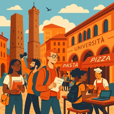
Place & Context: Europe’s oldest university core faces room-by-room letting shifts and street life noise friction against protected portico heritage.
5. Diaspora Marketplace (Southeast Asia)
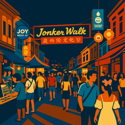
Place & Context: Jonker Street in Melaka showcases multilingual signage, clan associations, and Peranakan hybrid commerce along a revived UNESCO riverfront.
6. Sacred Waters & Tourism (South Asia)
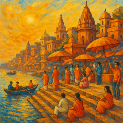
Place & Context: Varanasi’s stepped ghats represent a living sacred landscape balancing daily worship and ritual bathing with global tourism and environmental cleanup initiatives.
Why Study Cultural Geography
Understanding People and Place
Examines how human cultures interact with environments and how places are shaped by cultural practices, values, and identities, providing a lens for global diversity.
Exploring Identity and Belonging
Investigates how people assign symbolic meaning to places through architecture, art, and rituals, enriching appreciation for place-based identity.
Connecting Geography to Global Issues
Provides analytical tools to examine migration, urbanization, and climate justice through a cultural lens, fostering critical spatial thinking.
Developing Spatial Research Skills
Trains students in spatial analysis, GIS mapping, fieldwork observation, and qualitative interviewing essential across university disciplines.
Preparing for Impactful Careers
Opens professional pathways in urban planning, heritage conservation, international policy, ESG consulting, and GIS analysis.
Try It Yourself: Analyze a Place
- Choose a site: a market street, temple precinct, train station square, or riverside park.
- Observe: sketch a quick map; note languages on signs, smells/sounds, flows of people, times of peak use.
- Photograph ethically: avoid faces without consent; focus on material cues (architecture, stalls, rituals).
- Interview: 3 brief conversations—ask how people use the place and what it means to them.
- Synthesize: 5–7 insights connecting landscape features to identity, power, and change.
Deliverable: One annotated map + 200-word interpretation linking observations to a core spatial concept (e.g., diffusion, sense of place, cultural ecology).
Conclusion
Cultural geography is a vital field for understanding the dynamic relationship between human culture and the physical world. By exploring topics like urban cultural landscapes, migration patterns, and regional traditions, this discipline reveals how geography influences cultural behaviors and identities. From the symbolism of sacred spaces to the challenges of preserving cultural heritage in an increasingly globalized world, cultural geography offers profound insights into the forces that shape our societies and environments.
Frequently Asked Questions
What is Cultural Geography, and what does it study?
Cultural Geography studies how culture, identity, beliefs, practices, and values are shaped by—and in turn shape—the spaces, places, and environments people inhabit. It looks at how geography influences culture (through landscape, climate, migration, resources) and how cultural decisions transform places (through urban design, heritage, community spaces, borders, and globalisation).
How does Cultural Geography differ from physical geography or environmental science?
Unlike physical geography or environmental science, which focus on natural processes (like climate, geology, ecology), Cultural Geography emphasises human experiences, meaning, identity, and social relations embedded in space. It studies how people interpret and use places, how cultural practices vary across space, and how social, economic, political and historical factors influence landscapes and human-environment interactions.
What kinds of questions does Cultural Geography ask?
Questions include: How do migration, colonialism, trade, and globalisation affect the cultural identity of places? How do urbanisation and modern development change older cultural landscapes? How do people negotiate identity, memory, and heritage in multicultural or postcolonial contexts? How do diasporas or transnational communities maintain connections across space?
What methods does Cultural Geography use to study space and culture?
Cultural Geography employs methods such as field observation, ethnography, interviews, spatial mapping, GIS and digital mapping, archival research, historical cartography, and analysis of literature, art, and media. It often combines qualitative and quantitative approaches, allowing researchers to trace patterns, narratives, and spatial transformations over time and across regions.
Why is Cultural Geography important in a globalised world?
In a globalised world of migration, transnational identities, climate change, urban growth, and shifting borders, Cultural Geography helps us understand how global processes impact local identities and how communities adapt to change. It reveals how space, memory, heritage, displacement and belonging intersect, helping make sense of modern social, political, and environmental challenges.
What skills can I develop by studying Cultural Geography?
You can develop skills in spatial thinking, map reading, data interpretation, comparative cultural analysis, qualitative research, writing, and critical reflection. Understanding how geography and culture intertwine equips you to analyse urban planning, migration, heritage, environmental justice, globalisation, and social policy in context.
How does Cultural Geography connect with history, anthropology, or cultural studies?
Cultural Geography overlaps significantly with history, anthropology, cultural studies, sociology, urban planning, and environmental studies. It traces how cultural practices evolve in place and time, how societies adapt to physical environment, how migrations and exchanges change landscapes, and how identity, memory, and belonging are tied to land, architecture, and spatial organisation.
What kind of topics might be covered in a Cultural Geography module at university?
Topics may include urbanisation and city cultures, migration and diaspora, heritage and memory, national and regional identity, borderlands and postcolonial space, human-environment interactions, globalisation and localisation, spatial inequality, landscapes of conflict or reconciliation, and digital mapping and spatial media studies.
How is Cultural Geography typically assessed?
Assessment often includes essays, case studies, map-based assignments, spatial analysis, fieldwork reports, presentations, and sometimes community or development projects. You may be asked to interpret spatial data, reflect on cultural landscapes, analyse migration patterns, or compare regions historically and socially.
What career paths can Cultural Geography lead to?
Cultural Geography graduates may work in urban and regional planning, heritage and conservation, NGO and development work, environmental and human-rights advocacy, migration and refugee support, social research, cultural resource management, policy analysis, journalism, GIS analysis, tourism, and community development roles requiring spatial-cultural understanding.
How can I prepare now if I want to study Cultural Geography at university?
You can start by exploring maps — historical, cultural, and social. Read about migration, cities, heritage, and globalisation. Visit places with layered histories, reflect on how space and memory overlap, follow relevant documentaries or articles, and practise writing reflections on your observations. Getting comfortable with spatial thinking and cultural context will give you a head start.
Interactive Review Questions & Concept Explanations
Click on any question below to reveal detailed answers and spatial explanations:
1. What is cultural geography and how does it differ from physical geography?
Cultural geography is the study of how human culture interacts with and shapes the physical environment, focusing on aspects such as identity, language, and social practices that are tied to specific places. It differs from physical geography, which concentrates on the natural features and processes of the earth, like climate and landforms. Cultural geographers analyze how cultural values and social behaviors are influenced by the geographical context and vice versa. This interdisciplinary approach helps to illuminate the dynamic relationships between people and their environments, providing a nuanced understanding of both cultural expression and spatial organization.
2. How do cultural geographers use historical analysis in their research?
Cultural geographers use historical analysis to trace the evolution of cultural landscapes and understand how past events have shaped present-day social and spatial patterns. They examine archival documents, maps, and artifacts to reconstruct the historical context of a place, revealing how cultural identities and social structures have developed over time. This method allows researchers to identify long-term trends and the influence of historical processes on cultural practices. By situating contemporary cultural phenomena within a historical framework, cultural geographers can better interpret changes in identity and the significance of place in shaping human experience.
3. What methodologies are commonly employed in cultural geography studies?
Cultural geography studies commonly employ qualitative methodologies such as ethnography, participant observation, and in-depth interviews, along with spatial analysis using GIS (Geographic Information Systems). These methods allow researchers to gather rich, contextual data about how individuals and communities interact with their environments. They combine fieldwork with theoretical analysis to interpret the meanings attached to places and cultural practices. This mixed-method approach provides a comprehensive understanding of the complex interplay between culture and geography, revealing both the subjective experiences and objective patterns that define human landscapes.
4. How does the concept of “place” influence cultural identity according to cultural geography?
The concept of “place” is central to cultural geography because it embodies the physical and symbolic environments that shape personal and collective identities. Places provide a sense of belonging and continuity, influencing how individuals perceive themselves and relate to others within a community. Cultural geographers argue that the unique characteristics of a place—its history, landscape, and cultural practices—contribute to the formation of identity and social cohesion. This understanding underscores the importance of preserving local heritage and recognizing the role of geography in the continuous evolution of culture.
5. What role do maps and spatial analysis play in cultural geography?
Maps and spatial analysis are critical tools in cultural geography as they visually represent the distribution and relationships of cultural phenomena across different regions. By using Geographic Information Systems (GIS), researchers can analyze spatial patterns and visualize data such as population distribution, cultural landmarks, and migration flows. These visualizations help to reveal correlations between cultural practices and geographic factors, offering insights into how space influences social behavior. Maps serve not only as analytical tools but also as means of communicating complex cultural and historical information in an accessible format.
6. How do cultural geographers address the impact of globalization on local cultures?
Cultural geographers address the impact of globalization on local cultures by examining the ways in which global flows of information, people, and commodities influence cultural practices and identities. They explore how traditional cultural expressions are transformed or hybridized in the context of global interactions, and how local communities adapt to external influences. This research often involves comparing local cultural practices before and after globalization to assess changes in identity and social structure. By highlighting both the challenges and opportunities presented by globalization, cultural geographers provide a nuanced understanding of cultural resilience and transformation.
7. What is the significance of fieldwork in cultural geography?
Fieldwork is a cornerstone of cultural geography because it enables researchers to immerse themselves in the environments they study and to gather firsthand data on cultural practices and spatial relationships. Through participant observation, interviews, and direct engagement with communities, cultural geographers can capture the lived experiences and perceptions of the people in a specific place. This method provides rich, contextual insights that are essential for understanding the complex interactions between culture and geography. Fieldwork not only enriches the research findings but also fosters a deeper, empathetic connection with the subjects under study.
8. How does cultural geography contribute to our understanding of migration and urban development?
Cultural geography contributes to our understanding of migration and urban development by examining the spatial patterns and cultural dynamics that drive population movements and the growth of cities. It analyzes how migrants bring their cultural practices with them, influencing urban landscapes and reshaping social identities. This field explores the tensions and synergies between different cultural groups in urban settings, revealing how diverse communities negotiate space and identity. By linking migration patterns with urban development, cultural geography provides valuable insights into the challenges and opportunities of multicultural urban environments.
9. How can cultural geography help in preserving local heritage and promoting sustainable development?
Cultural geography helps in preserving local heritage by documenting and analyzing the unique cultural practices and landscapes that define a community’s identity. It offers strategies for protecting historical sites, traditional practices, and indigenous knowledge against the pressures of modernization and globalization. By understanding the deep connections between culture and place, policymakers and community leaders can develop sustainable development plans that respect and incorporate local heritage. This integrated approach ensures that development initiatives are culturally sensitive and promote long-term environmental and social sustainability.
10. How does cultural geography explain the relationship between landscape and power dynamics in society?
Cultural geography explains the relationship between landscape and power dynamics by exploring how physical spaces are used to exert control and influence over populations. It examines how the design, organization, and symbolism of landscapes reflect and reinforce social hierarchies, political authority, and cultural values. Through spatial analysis, cultural geographers reveal how urban planning, architectural design, and public spaces can either democratize or concentrate power within a society. This critical perspective highlights the interplay between the built environment and societal structures, providing insights into the ways in which geography shapes and is shaped by power relations.
Comprehensive Cultural Geography Practice Module
Part 1: Foundational Spatial Mastery & Core Concepts
-
Explain Carl Sauer’s definition of a “cultural landscape.”
Answer: Carl Sauer defined a cultural landscape as the fashioning of a natural landscape by a cultural group, where culture is the agent, the natural area is the medium, and the cultural landscape is the resulting physical imprint. -
Differentiate between formal, functional, and vernacular cultural regions.
Answer: A formal region is defined by uniform cultural traits (e.g., language distribution); a functional region is organized around a focal node or interaction corridor (e.g., subway system); a vernacular region exists through perceptual identity (e.g., “the Rust Belt”). -
Contrast environmental determinism with possibilism in geographical history.
Answer: Environmental determinism argues that physical environment strictly dictates human culture and societal development, whereas possibilism asserts that while environment sets limits, humans have the cultural agency to adapt and overcome environmental constraints. -
Define “time-space compression” as developed by David Harvey.
Answer: Time-space compression refers to the technological innovations in transportation and telecommunications that dramatically reduce the time required to cross spatial distances, making the world feel conceptually smaller. -
What is “studentification” and how does it alter urban cultural geography?
Answer: Studentification is the social, cultural, and physical transformation of urban neighborhoods resulting from growing student populations, leading to room-by-room housing conversion, altered night-time economies, and potential displacement of long-term residents. -
Explain the concept of a “diaspora marketplace.”
Answer: A diaspora marketplace is a commercial urban space (e.g., Jonker Street) created by transnational migrant networks, characterized by multilingual signage, hybrid goods, and imported cultural traditions integrated into local trade. -
What is the difference between relocation diffusion and contagious diffusion?
Answer: Relocation diffusion occurs when individuals physically move to a new location and carry their culture with them (e.g., migration); contagious diffusion is the rapid, widespread spread of a cultural trait through direct contact without bodily relocation. -
Define “sense of place” within humanistic geography.
Answer: Sense of place refers to the subjective, emotional, and psychological attachment that individuals or groups develop toward a specific geographical location based on personal memories, heritage, and lived experience.
Part 2: Analytical & Scenario-Based Spatial Inquiries
-
Analyze how short-term digital rental platforms (e.g., Airbnb) impact the cultural authenticity and housing geography of historic European quarters like Lisbon’s Alfama.
Answer: Digital rental platforms accelerate gentrification by commodifying residential real estate for tourists, driving up rent levels, displacing multi-generational households, and replacing everyday essential services (grocers, cobblers) with tourist-oriented retail and F&B, which erodes traditional community social cohesion. -
Evaluate the “Bilbao Effect” as a model for creative-led urban regeneration.
Answer: The “Bilbao Effect” demonstrates how high-profile cultural infrastructure investments (such as the Guggenheim Museum) can successfully rebrand post-industrial waterfronts into global cultural hubs. However, spatial critics note it risks creating visual inequality if economic benefits fail to penetrate adjacent working-class neighborhoods. -
Examine how sacred riverfronts (such as Varanasi’s ghats) reconcile religious worship with global tourism expansion.
Answer: Sacred spaces negotiate dual identities through spatial micro-zoning: preserving core ritual steps for devotional bathing and cremation while designated boat routes, commercial platforms, and municipal promenades accommodate tourists, requiring active waste management to prevent ecological degradation. -
How do colonial map-making and border demarcation continue to influence postcolonial regional geopolitics?
Answer: Imperial powers drew geometric borders without regard for indigenous ethnic, linguistic, or ecological boundaries, creating divided communities or forcing rival groups into unified state structures, which frequently fuels postcolonial territorial disputes and secessionist movements. -
Discuss how GIS and remote sensing technology enhance historical cultural geography research.
Answer: GIS enables researchers to overlay multi-temporal spatial datasets (historical maps, satellite imagery, census archives) to visualize long-term land-use changes, track demographic shifts, and map the spatial diffusion of cultural phenomena across centuries. -
How does the concept of “topocide” describe the destruction of cultural landscapes during rapid urban expansion?
Answer: Topocide refers to the deliberate or collateral destruction of an established human landscape, along with its associated memory and sense of place, through aggressive industrialization, dam construction, or wholesale urban renewal. -
Analyze the role of five-foot ways in Southeast Asian shophouse architecture as transitional cultural spaces.
Answer: Five-foot ways serve as covered pedestrian walkways that blur the boundary between private commerce and public street life, fostering social interaction, street vending, and climate-sheltered urban activity in tropical climates. -
Explain how linguistic geography maps dialect continua and language shift.
Answer: Linguistic geography analyzes the spatial distribution of languages and dialects across physical barriers, mapping isoglosses (boundaries of linguistic features) to demonstrate how geographical isolation or trade corridors drive language preservation or assimilation.
Part 3: Spatial Calculations & Quantitative Geographic Models
According to the gravity model of spatial interaction, interaction intensity I between two cities is given by:
I = (P1 × P2) / D2 City A has a population P1 = 500,000 and City B has P2 = 200,000, located at distance D = 50 km. Compute the interaction index I.
Solution Steps:
1. Numerator = 500,000 × 200,000 = 100,000,000,000.
2. Denominator = 502 = 2,500.
3. Interaction Index I = 100,000,000,000 / 2,500 = 40,000,000.
Conclusion: The spatial interaction index between City A and City B is 40,000,000 units.
A historic urban district with 12,000 permanent residents hosts an average daily peak visitor flux of 48,000 tourist-days. Calculate the tourist density ratio per resident and determine the percentage increase in total daily population.
Solution Steps:
1. Tourist-to-resident ratio = 48,000 / 12,000 = 4.0 tourists per resident.
2. Total daily presence = 12,000 + 48,000 = 60,000 individuals.
3. Percentage increase = (48,000 / 12,000) × 100 = 400% expansion.
Conclusion: The district experiences an overtourism density of 4 tourists per resident, expanding daily presence by 400%.
In 2005, a heritage neighborhood comprised 850 long-term rental units out of 1,000 total dwellings. By 2025, 510 units had been converted into short-term tourist lets. Calculate the percentage reduction in long-term housing stock.
Solution Steps:
1. Initial long-term rentals = 850.
2. Remaining long-term rentals = 850 − 510 = 340 units.
3. Percentage reduction = (510 / 850) × 100 = 60.0%.
Conclusion: Long-term rental housing stock contracted by exactly 60% over the 20-year period.
According to George Zipf’s Rank-Size Rule, the population of the n-th ranked city is Pn = P1 / n. If the largest primate city in a country has a population P1 = 4,000,000, calculate the predicted populations for the 2nd, 4th, and 8th ranked regional cities.
Solution Steps:
1. 2nd ranked city P2 = 4,000,000 / 2 = 2,000,000.
2. 4th ranked city P4 = 4,000,000 / 4 = 1,000,000.
3. 8th ranked city P8 = 4,000,000 / 8 = 500,000.
Conclusion: Zipf’s rule predicts populations of 2.0M, 1.0M, and 500k for ranks 2, 4, and 8 respectively.
Location Quotient measures spatial concentration:
LQ = (Local Sector Employment / Local Total Employment) / (National Sector Employment / National Total Employment) A city has 3,000 art design workers out of 50,000 total employees. Nationally, there are 40,000 art design workers out of 1,000,000 total employees. Calculate the Location Quotient.
Solution Steps:
1. Local proportion = 3,000 / 50,000 = 0.06 (6%).
2. National proportion = 40,000 / 1,000,000 = 0.04 (4%).
3. Location Quotient LQ = 0.06 / 0.04 = 1.5.
Conclusion: The city’s LQ is 1.5, indicating a strong regional specialization in creative industries (50% higher than national average).
If a cultural innovation’s adoption rate decreases by 25% for every 10 km traveled from the origin node, calculate the remaining adoption rate at a distance of 30 km.
Solution Steps:
1. Retained rate factor per 10 km = 1 − 0.25 = 0.75.
2. Number of 10 km intervals in 30 km = 30 / 10 = 3 intervals.
3. Retained rate = (0.75)3 = 0.421875 or 42.19%.
Conclusion: At 30 km from origin, the adoption intensity drops to 42.19% of its original strength.
An urban greening policy increases street tree canopy cover from 12% to 28% across a district. If empirical climate models indicate that every 10% increase in tree canopy reduces average surface urban heat island temperature by 0.6°C, calculate the net temperature reduction.
Solution Steps:
1. Absolute canopy increase = 28% − 12% = 16%.
2. Temperature reduction = (16% / 10%) × 0.6°C = 1.6 × 0.6°C = 0.96°C.
Conclusion: The canopy expansion will reduce average local urban heat island temperatures by 0.96°C.